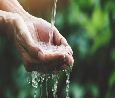
Water is a vital resource that binds us all; it is our duty to protect it
Geophysical Survey & Groundwater Management
"We use suitable and effective geophysical methods to study subsurface conditions for locating and assessing groundwater
resources and making their sources sustainable."
Geophysical Surveys
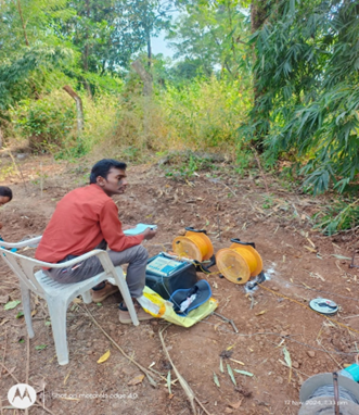
By Using Electrical Resistivity Principle (Background Methodology)

By Using Very Low Frequency Electromagnetic Field
- Purpose
- Identify underground water sources (aquifers) for borewell drilling or irrigation.
- Map mineral resources like oil, gas, or metal ores.
- Study geological features such as faults, bedrock, and soil layers.
- Assess sites for construction or infrastructure projects.
- Conduct archaeological investigations.
- Applications
- Locating suitable drilling spots for borewells.
- Finding groundwater or analyzing aquifers for water resource management.
- Site evaluations for construction, such as buildings, bridges, or tunnels.
- Exploration for natural resources or hazardous material studies.
Borewell Drilling
4and ½ 6 and ½
Borewell Drilling

Our Borewell Drilling Process
- Geo-hydrology Survey: We start with a thorough geo-hydrology survey to analyze the underground water table. This critical step helps us identify the best drilling location, ensuring efficient water extraction and minimizing potential drilling challenges.
- Precision Drilling: Using advanced drilling technology, we access water sources deep beneath the ground. Our expert team ensures minimal disruption to your property and precise drilling to reach the optimal water level.

In borewell drilling, the terms 4 ½ inch and 6 ½ inch refer to the diameters of the borewell. Here’s what they mean:
4 ½ Inch Borewell
- Typically used for domestic purposes.
- Has a smaller diameter, requiring less drilling time and cost.
- Suitable for hand pumps or small submersible pumps.
- Depth usually ranges between 100 to 600 feet, depending on groundwater availability.
6 ½ Inch Borewell
- Designed for agricultural, industrial, or large-scale water needs.
- Larger diameter allows for higher water output and installation of more powerful pumps.
- Can reach greater depths, often exceeding 1,000 feet.
- More expensive due to increased drilling effort and casing requirements.

Benefits of Borewell Drilling
Reliable Water Supply:
Borewells provide a consistent water source, essential for daily needs and agricultural activities, especially in water-scarce regions.
Water Conservation:
By tapping into underground water sources, borewells help conserve surface water and reduce dependency on external water supplies.
Increased Property Value: A functional borewell can enhance the value of your property by ensuring a reliable water supply.
Assessment
Aquifer Mapping
Recharge & Conservation
Artificial Recharge
Conservation Practices
Community Involvement
Stakeholder Engagement
Local Groundwater Management Initiatives
Get in Touch—
Ready to explore borewell drilling for your home or community building or industry ? Contact Green Arch Associates today for a free consultation and detailed estimate.